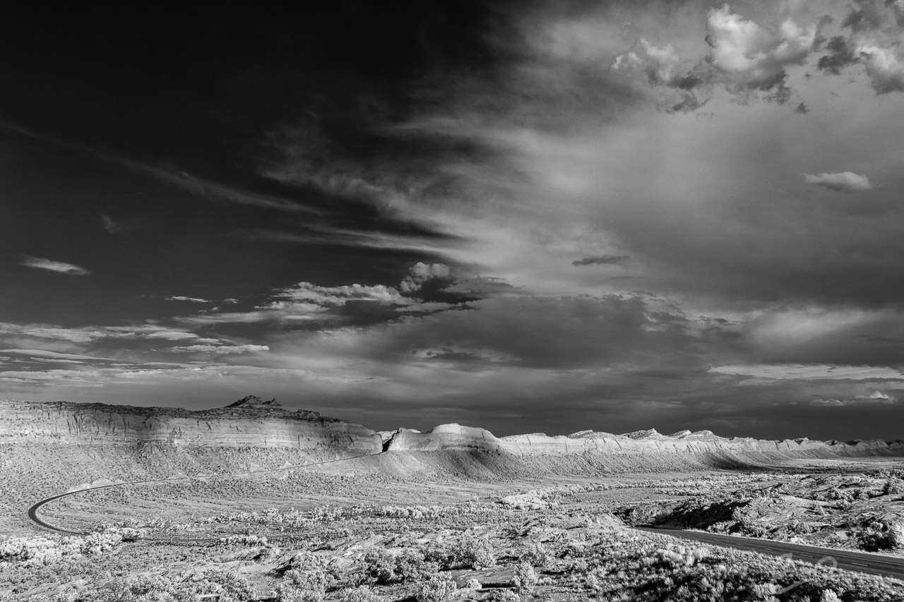

Final, and favorite, image from mine and my daughter’s drive from Torrey, UT and Capitol Reef National Park across Utah to Monticello, UT and a few days among Edward Abbey‘s Arches National Park and Canyonlands National Park. This shot is also from along Utah State Route 95 just west of Blanding, UT.
As I rounded the corner and started down into this valley I jumped on the brakes and turned around to get a shot. I parked the car, threw on my hiking boots, and started walking over to some sandstone that would get me a little more elevation. There was a gentle breeze that must have been much stiffer higher up because the clouds and their shadows were dancing along the far cliff. I sat and took several different pictures trying to get the perfect balance of light and shadow. Overall spent nearly 20 minutes trying different compositions and naturally the first one is the one that ultimately turned out the best (Google Map).
Comments